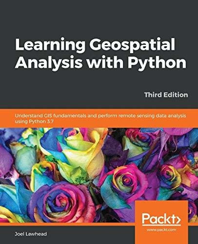
Book : Learning Geospatial Analysis With Python Understand.
Pagá en cuotas
Llega gratis entre el 10 y el 11/jul
Retirá gratis entre el 10 y el 15/jul en correo y otros puntos
Ver en el mapaDisponible 15 días después de tu compra
MercadoLíder | +10mil ventas
MercadoLíder Platinum
+10mil
Ventas concretadas
Brinda buena atención
Despacha sus productos a tiempo


Características del producto
Características principales
Título del libro | Learning Geospatial Analysis With Python Understand Gis Fun |
|---|---|
Autor | Lawhead, Joel |
Idioma | Inglés |
Editorial del libro | Packt Publishing |
Tapa del libro | Blanda |
Año de publicación | 2019 |
Marca | Packt Publishing |
Modelo | Ingles |
Otras características
Cantidad de páginas | 456 |
|---|---|
Tipo de narración | Novela |
ISBN | 9781789959277 |
Descripción
- ANTES DE COMPRAR PREGUNTE FECHA DE ENTREGA.
- ENVIAMOS POR MERCADOENVIOS
- PUEDE RETIRAR POR AHORA SOLO POR QUILMES, MICROCENTRO ESTA CERRADO, POR ESO...
- EN CABA (CAPITAL FEDERAL) ENVIAMOS SIN CARGO ESTE PRODUCTO.
- FORMA DE PAGO : MERCADOPAGO
- HACEMOS FACTURA A.
- ELBAZARDIGITAL VENDEDOR PLATINUM
- TODOS NUESTROS PRODUCTOS EN:
https://eshops.mercadolibre.com.ar/elbazardigital
-X-X-X-
- SOMOS IMPORTADORES DIRECTOS, ESTE PRODUCTO SE COMPRA Y SE IMPORTA DESDE ESTADOS UNIDOS, ESTO IMPLICA QUE USTED ESTA COMPRANDO EL MISMO PRODUCTO QUE COMPRARÍA UN CLIENTE DE ESE PAÍS.
- ANTES DE REALIZAR UNA CONSULTA, VISUALICE TODAS LAS IMAGENES DEL PRODUCTO.
Descripción provista por la editorial :
Learn the core concepts of geospatial data analysis for building actionable and insightful GIS applicationsKey FeaturesCreate GIS solutions using the new features introduced in Python 3.7 Explore a range of GIS tools and libraries such as PostGIS, QGIS, and PROJ Learn to automate geospatial analysis workflows using Python and JupyterBook DescriptionGeospatial analysis is used in almost every domain you can think of, including defense, farming, and even medicine. With this systematic guide, youll get started with geographic information system (GIS) and remote sensing analysis using the latest features in Python. This book will take you through GIS techniques, geodatabases, geospatial raster data, and much more using the latest built-in tools and libraries in Python 3.7. Youll learn everything you need to know about using software packages or APIs and generic algorithms that can be used for different situations. Furthermore, youll learn how to apply simple Python GIS geospatial processes to a variety of problems, and work with remote sensing data. By the end of the book, youll be able to build a generic corporate system, which can be implemented in any organization to manage customer support requests and field support personnel.What you will learnAutomate geospatial analysis workflows using Python Code the simplest possible GIS in just 60 lines of Python Create thematic maps with Python tools such as PyShp, OGR, and the Python Imaging Library Understand the different formats that geospatial data comes in Produce elevation contours using Python tools Create flood inundation models Apply geospatial analysis to real-time data tracking and storm chasingWho this book is forThis book is for Python developers, researchers, or analysts who want to perform geospatial modeling and GIS analysis with Python. Basic knowledge of digital mapping and analysis using Python or other scripting languages will be helpful.Table of ContentsLearning about Geospatial Analysis with PythonLearning Geospatial DataThe Geospatial Technology LandscapeGeospatial Python ToolboxPython and Geographic Information SystemsPython and Remote SensingPython and Elevation DataAdvanced Geospatial Python ModelingReal-Time DataPutting It All Together About the Author Joel Lawhead is a PMI-certified Project Management Professional, a certified GIS Professional, and the Chief Information Officer of NVision Solutions Inc., an award-winning firm specializing in geospatial technology integration and sensor engineering for NASA, FEMA, NOAA, the US Navy, and many other commercial and non-profit organizations. Joel began using Python in 1997 and started combining it with geospatial software development in 2000. He has authored multiple editions of Learning Geospatial Analysis with Python and QGIS Python Programming Cookbook, both from Packt. He is also the developer of the open source Python Shapefile Library (PyShp) and maintains a geospatial technical blog, GeospatialPython, and Twitter feed, @SpatialPython.
-o-o-o-
Garantía del vendedor: 90 días
Preguntas y respuestas
¿Qué querés saber?
Preguntale al vendedor
Nadie hizo preguntas todavía.
¡Hacé la primera!

